
Carl and Barbara Segerstrom Preserve at Squam Creek


A fun activity to do while on the trails

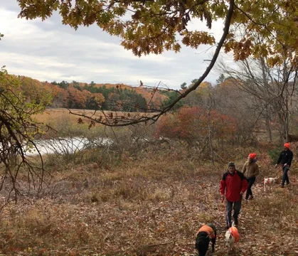
Take in the view from the “picnic log” along the Jeremy’s Ramble trail.
Preserve users can walk along Jeremy’s Ramble Trail, exploring several short side trails. These blazed trails begin at the parking area off West Shore Road and proceed through hardwood forest, along a picturesque stone wall and by the lush green marsh grass of the wetland along the creek. Several viewpoints offer spectacular views of the tidal salt marsh, supporting a variety of bird populations, river otters and a commercial oyster farm.
This 159-acre preserve protects significant wetland habitats, 3,300 feet of shoreline along Squam Creek, deer wintering habitat and historic cellar holes and cemeteries. The property was one of the first settled on Westport Island, around 1740 by Timothy Dunton and his family. The southern part of the property was settled by the Hodgdon family shortly thereafter. The foundation of the Hodgdon home, livestock pens, extensive stonewalls, and the family cemetery are beautifully preserved on this portion of the land.
Conservation of this property was possible through generous support from the Town of Westport Island, private foundations, the North American Wetland Conservation Act (NAWCA) and many community members. KELT is excited to share this new place to learn, explore and appreciate nature.

From Dave Seavey, grandson of Carl and Barbara Segerstrom, pictured to the left with his wife Michelle and six children at the 2017 preserve opening,
During the trip here before my Grandmother turned 90, she told me that she would sell this property once she turned 90 years old. She said it was only fitting since they had bought it many years earlier from a lady that had just turned 90 so it would be time to say goodbye to it. I’m glad she didn’t sell it then…I have a feeling if she had, it may have gone to a private owner and all of us wouldn’t have the opportunity to enjoy this land for many years to come and more importantly, to share it with all of you. I can imagine my kids bringing their kids here and it really puts a smile on my face. To know that they’ll enjoy it as much as I did.

- Driving Directions -
From Bath take Route 1 North for 6.8 miles and turn right onto Route 144. After 1 mile turn left to stay on 144 (Birch Point Road) and after another mile turn right to stay on 144. Follow for 6.5 miles then turn right onto West Shore Road. Follow across the causeway and up the hill, the parking lot is on the left. View Map.
Share what you see at Squam Creek!
Use iNaturalist to document the plants and animals you see while wandering through Segerstrom’s trails. The observations you make will appear below, use the tool to check out what people have already recorded!